State, local officials huddle over wildfire damages
Published 6:00 am Tuesday, August 6, 2024
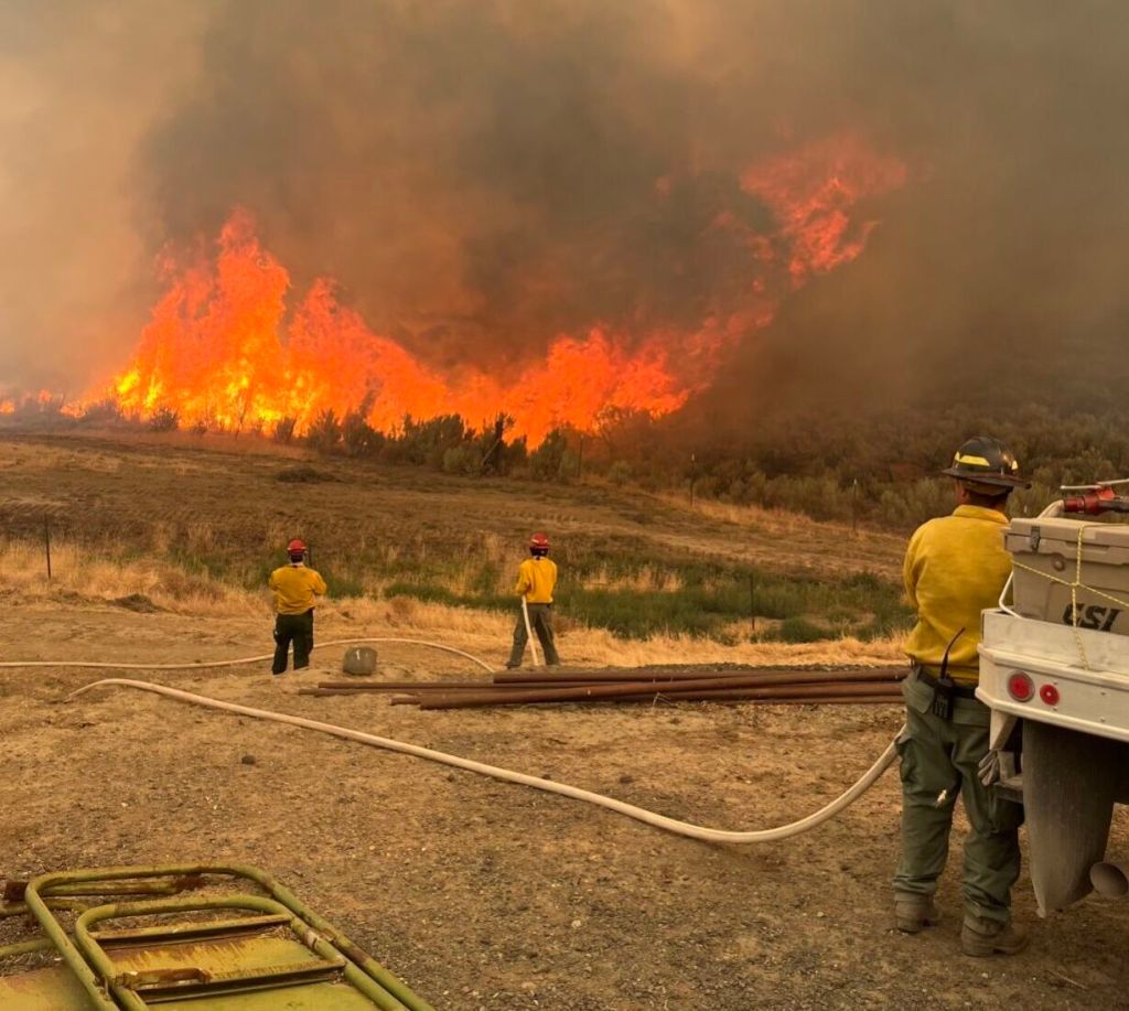
- A lightning-sparked wildfire burns July 22, 2024, near Durkee in Baker County. State and local officials huddled July 31 on a Zoom call to talk about how to access state and federal programs that could help offer assistance to localities and residents damaged by the wave of wildfires in Eastern Oregon.
SALEM — Leaders from throughout Eastern Oregon met recently with state officials to get what amounted to a refresher course about government programs intended to cover at least some of the losses caused by the wildfires ravaging the region.
Trending
It’s a complicated array of state and federal programs that could provide essential aid to fire-scarred counties and their residents, but the programs have at least one thing in common: They require documentation about damages before they’ll pay out a cent.
So a major theme of the hour-long meeting July 31 was about the importance of gathering that documentation — as early and as often as possible — and keeping it readily available to use in applications for the aid programs.
“Data is king,” said Sage DeLong, Umatilla County emergency manager. “So we might not know that we need the data right now. But we want to collect as much as we can. … The best thing I can say is track everything, even if you don’t think you need it.”
Trending
For example, DeLong advocated taking time-stamped photos to document damages. Others on the call urged counties to coordinate data collection in an easily accessible location, where it could be used for applications to several different assistance programs.
Other officials on the Zoom call, sponsored by the Eastern Oregon Counties Association, noted this summer’s fires in Eastern Oregon have been different in some ways than Oregon’s fires in the summer of 2020.
“So much of the damage that we’re seeing is either on public grazing land or public timberland or private land as well,” said Courtney Crowell, the Eastern Oregon regional solutions coordinator for Gov. Tina Kotek’s office.
And that means some damage might not be apparent immediately, officials said.
“Some of these things are going to be hard to quantify,” said Todd Nash, a Wallowa County commissioner and the Republican nominee for state Senate District 29.
“There’s a lot of unknown stuff that’s still out there,” said Sen. Lynn Findley, R-Vale.
He said he’s talked to private ranchers who have lost all the interior fences on their grazing ground. Replacing those fences could cost up to $500,000, he said, “and that doesn’t show up on anybody’s radar right off the bat.”
Nash also talked about the potential loss of pasture for the next few years because of the fires, which could be a “devastating impact” for some ranchers. He emphasized the importance of making federal conservation lands available for grazing.
A letter sent last week from Kotek to U.S. Department of Agriculture Secretary Tom Vilsack urged the department to issue a USDA disaster declaration for 23 Oregon counties, including Baker, Gilliam, Grant, Harney, Malheur, Umatilla, Union and Wallowa. Kotek’s request, which was backed by every member of Oregon’s congressional delegation, would grant emergency-use authorizations for alternative grazing areas and flexibility in grazing schedules. It also would grant emergency waivers for the use of noncertified weed-free forage.
‘Indirect losses’
Other local officials on the call suggested damage from the fires might not be immediately apparent but could impact communities for years to come.
Grant County Commissioner Jim Hamsher noted what he called the “indirect losses” from the fires: “We’ve had road closures that stop people from coming to our county, we’ve closed our forests, which pretty much killed any travelers coming in, you have hotels that have seen 20 cancellations in a week. … So we’re probably going to need some help.”
Baker County Commissioner Bruce Nichols agreed: “There’s going to be some economic damage for several years to these Eastern Oregon counties,” he said. And he urged officials on the call to cast a broad net when they’re assessing potential damages from wildfires.
For example, he said, he’s heard that wildfire smoke can affect the grapes used in making wine, although he emphasized: “Whether this is true or not, I don’t know.” (It turns out to be true, according to a 2013 study from Oregon State University.)
But Nichols’ broader point was for officials to be on the lookout for unanticipated damages from the wildfire — and to be ready to “reach out to every single one of these organizations that we can come up with and try to get as much assistance as we possibly can.”
That aligned with the message from the state officials, who offered to provide as much help as possible — and who also urged local officials to work closely with their county emergency managers to coordinate documentation efforts.
State officials also warned that unexpected gaps might emerge as local governments sought assistance.
Erin McMahon, the director of the state’s Department of Emergency Management, said there might be cases in which disaster claims don’t reach federal thresholds for relief, leaving cash-strapped local governments scrambling.
“It’s important to annotate those and capture those gaps,” she said — and then to “think about how we prevent those kinds of breakdowns and gaps in the future.”
Size estimates are from Aug. 5.
Badland Complex: Baker County: 54,563 acres/99% contained
Battle Mountain Complex: Grant, Umatilla and Morrow counties: 181,941 acres/36% contained
Courtrock Fire: Grant County: 20,018 acres/57% contained
Cougar Creek Fire: Wallowa County and Asotin and Garfield (Washington) counties: 17,602 acres
Durkee Fire: Baker and Malheur counties: 294,690 acres/86% contained
Falls Fire: Harney and Grant counties: 146,113 acres/73% contained
Lone Rock Fire: Gilliam, Morrow and Wheeler counties: 137,221 acres
Source: National Interagency Fire Center
Marketplace


-
eEdition

-

-
